
- Version
- Download 35
- File Size 31 MB
- File Count 1
- Create Date 2023-04-05
- Last Updated 2024-12-02
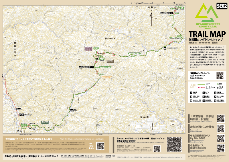
Trail map Southeast SE02
Trail map Southeast SE02 of the Ibaraki Kenpoku Long Trail.
You can download an A3 horizontal map in PDF format, as shown in the image above, which shows the area around SE-06 to SE-18.
Please print it out and use it.
※Update 5 April 2023.
この投稿文は次の言語で読めます: 日本語 (Japanese)