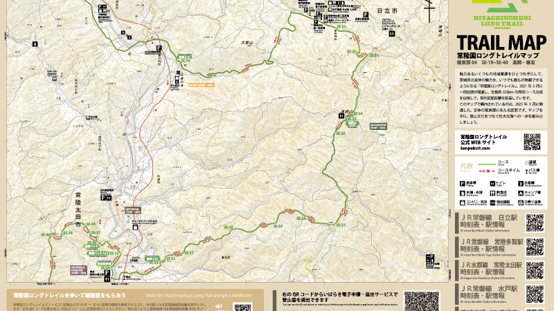
| Trail map Southeast SE04 of the Hitachinokuni Long Trail. You can download an A3 horizontal map in PDF format, as shown in the image above, which shows the area around SE-19 to SE-40. Please print it out... | |
| Version | |
| Total Files | 1 |
| File Size | 31 MB |
| Create Date | 2023-04-05 |
| Last Updated | 2024-12-02 |
| Download | |
